IGiS Desktop

5
Overall rating
Reviews

5
Overall rating
(1)
Reviews

About IGiS Desktop

IGiS Desktop is a GIS Software integrated with Image Processing, Photogrammetry, and CAD (Computer-Aided Design) modules. IGiS Desktop aims to redefine the GIS (Geographic Information System)software industry with integrated GIS mapping, and image processing capabilities with advanced analysis extensions on a single platform. It makes collaboration easy with Open Geospatial Consortium (OGC)-supported platforms. Standardized UI and ribbon-based navigation make the user-interface intuitive and interactive. IGiS enables you to store, manage and edit geospatial data seamlessly. It is an innovative tool that supports data integration for a wide range of geospatial data formats, including real-time and big data. Integration of OGC Standards enables you to store and share data with other users through privileged authentication. GIS technology integrated with the CAD module builds extensive GIS mapping software to carry out cartographic as well as engineering capabilities for real-world objects.
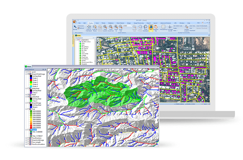
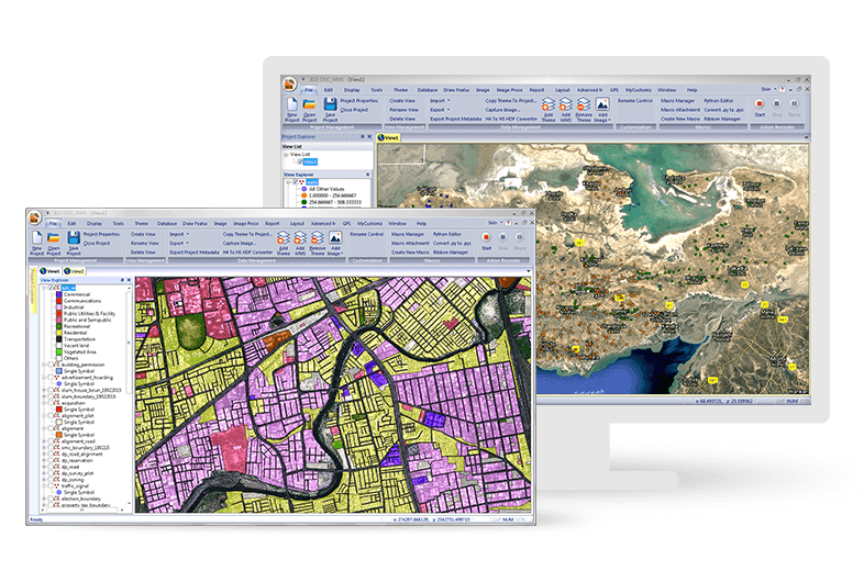
IGiS Desktop Software - Next-generation cartographic and visualisation tools for conceptualisation, production, dissemination, and analysis of 2D & 3D maps. It is a 64-bit, Unicode compliant Desktop GIS with an intuitive user interface where data can be viewed in multiple tabs.
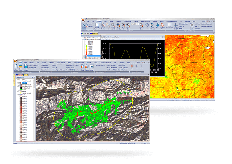
IGiS Desktop Software - IGiS aims to redefine the GIS industry with integrated GIS and Image Processing capabilities with advanced analysis extensions on a single platform. Standardized UI and ribbon-based navigation makes it easy to use and adapt, w/ OGC Compilant Platform.
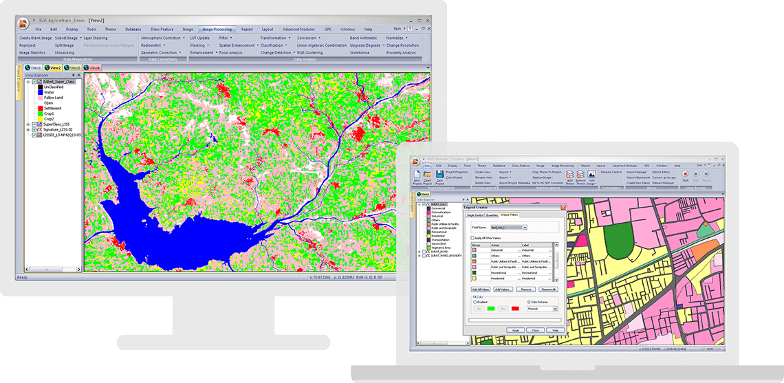
IGiS Desktop Software - IGiS has advanced tools for GIS data conversion, analysis, and visualisation. Advance geospatial users can effectively use tools like Topology creation, Geo-processing, overlay analysis, attribute query builder for desired analysis and output.
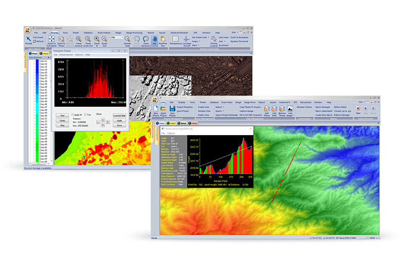
IGiS Desktop Software - IGiS has a rich array of tools and analytical models to analyse and process images. It can manage a multitude of image sources like aerial, satellite, optical, microwave, LIDAR, stereo, GPR, and more.
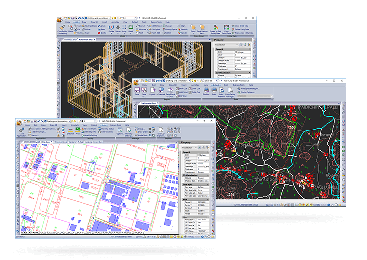
IGiS Desktop Software - IGiS CAD is an extensive mapping tool with cartographic as well as engineering capabilities for mapping real-world objects. IGiS CAD has efficient, fast, user-friendly and feature rich tool to convert and digitize 2D and 3D GIS data.
IGiS Desktop Software - IGiS enables you to store, manage, and edit geospatial data seamlessly. It is a comprehensive tool that supports data integration for a wide range of geospatial data formats including real-time sensor data and big data.
IGiS Desktop Software - Next-generation cartographic and visualisation tools for conceptualisation, production, dissemination, and analysis of 2D & 3D maps. It is a 64-bit, Unicode compliant Desktop GIS with an intuitive user interface where data can be viewed in multiple tabs. - thumbnail
IGiS Desktop Software - IGiS aims to redefine the GIS industry with integrated GIS and Image Processing capabilities with advanced analysis extensions on a single platform. Standardized UI and ribbon-based navigation makes it easy to use and adapt, w/ OGC Compilant Platform. - thumbnail
IGiS Desktop Software - IGiS has advanced tools for GIS data conversion, analysis, and visualisation. Advance geospatial users can effectively use tools like Topology creation, Geo-processing, overlay analysis, attribute query builder for desired analysis and output. - thumbnail
IGiS Desktop Software - IGiS has a rich array of tools and analytical models to analyse and process images. It can manage a multitude of image sources like aerial, satellite, optical, microwave, LIDAR, stereo, GPR, and more. - thumbnail
IGiS Desktop Software - IGiS CAD is an extensive mapping tool with cartographic as well as engineering capabilities for mapping real-world objects. IGiS CAD has efficient, fast, user-friendly and feature rich tool to convert and digitize 2D and 3D GIS data. - thumbnail
IGiS Desktop Software - IGiS enables you to store, manage, and edit geospatial data seamlessly. It is a comprehensive tool that supports data integration for a wide range of geospatial data formats including real-time sensor data and big data. - thumbnail

IGiS Desktop pricing

Starting Price:
Not provided by vendor
Free Version:
No
Free trial:
No

Alternatives to IGiS Desktop

OverIT Next-Gen FSM Platform

OverIT provides leading software solutions for end-to-end FSM at scale. Our ability to innovate is driven by our 20...

IGiS Enterprise Suite

IGiS Enterprise Suite is a scalable geographic information system (GIS) solution designed to securely share geospatial...

IGiS Photogrammetry Suite

IGiS Photogrammetry Suite is a fully automated solution providing geodesy and photogrammetry tools. The suite can be...

IGiS Desktop Reviews

Feature rating

Value for Money
5
Functionality
5
Ease of Use
4
Customer Support
5
1 review
Verified Reviewer
  • Industry: Health, Wellness & Fitness
  • Company size: 201–500 Employees
  • Used Weekly for 6-12 months
  • Review Source
Value for Money
5
Functionality
5
Ease of Use
4
Customer Support
5

5
Reviewed on 22/09/2023

Best GIS Software for Visualizing Hospital and Healthcare Data

I used IGiS Desktop for hospita and healthcare data visulisation and management. Also, for predictive analytics and route management IGiS is a best GIS solution.

Pros

It's ata visualization and analysis tool I liked the most, It helped me to collect most accurate data.

Cons

Nothing I dislike about IGiS Desktop as it has all what I need.

Related categories