Overall rating
(0)
Reviews

0
Overall rating
(0)
Reviews

About SkyDeck

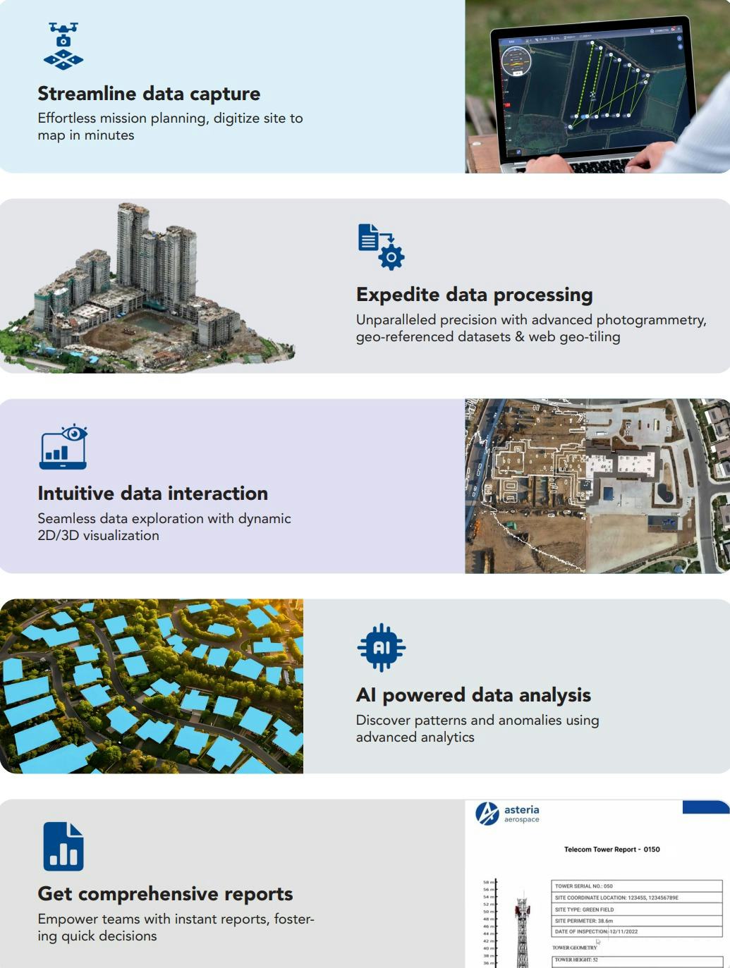
Deploy SkyDeck by Asteria Aerospace, a unified cloud-based SaaS platform is for end-to-end drone fleet management, scheduling and executing drone flights, data processing, and visualization, AI-based analysis and reporting of aerial data captured using drones. SkyDeck ensures operational transparency, improves collaboration between stakeholders, and provides secure and centralized management for scaling drone programs across multiple applications. |Data Capture: mission planning, precision flights, on ground quality checks. Digitize site to map in minutes, with the accuracy of RTK/PPK geo-tagging. |Data Processing: high-resolution drone imagery, structured, geo-referenced datasets. Unparalleled precision with advanced photogrammetry and web geo-tiling. |Data Interaction: data exploration with dynamic 2D/3D visualization. Engage, analyze, and interact with data featuring overlay, tagging, and annotation. |Data Analytics: AI-powered insights, advanced analytics. |Instant cloud- based report from flight to finding
SkyDeck Software - SkyDeck by Asteria Aerospace.
Recommended Drone Insights tool by Drone-as-a-service providers, DaaS Project Managers, Asset Managers, GIS Engineers/ Analysts
Recommended Drone Insights tool by Drone-as-a-service providers, DaaS Project Manager
SkyDeck Software - Recommended Drone Insights tool by Drone-as-a-service providers, DaaS Project Managers, Asset Managers, GIS Engineers/ Analysts
SkyDeck by Asteria Aerospace - End-to-End Drone Data Management platform for Accurate Insights
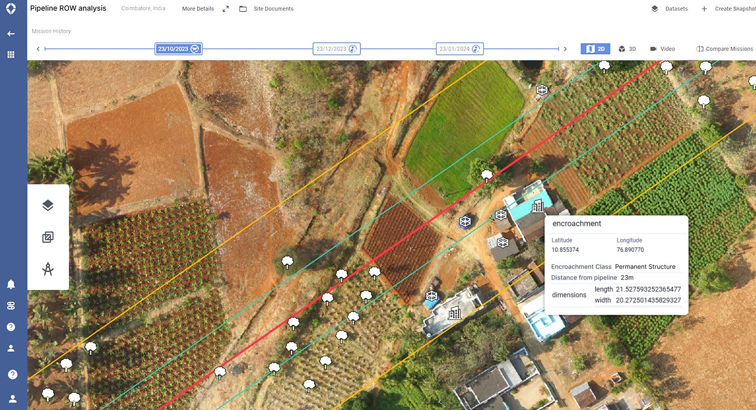
SkyDeck Software - Pipeline Encroachment Analysis: Al-powered ROW encroachment detection, Encroachment type and severity classification, Distance of encroachment from pipeline, Closest chainage marker, Change detection between surveys, Multiple pipelines in ROW. 
SkyDeck
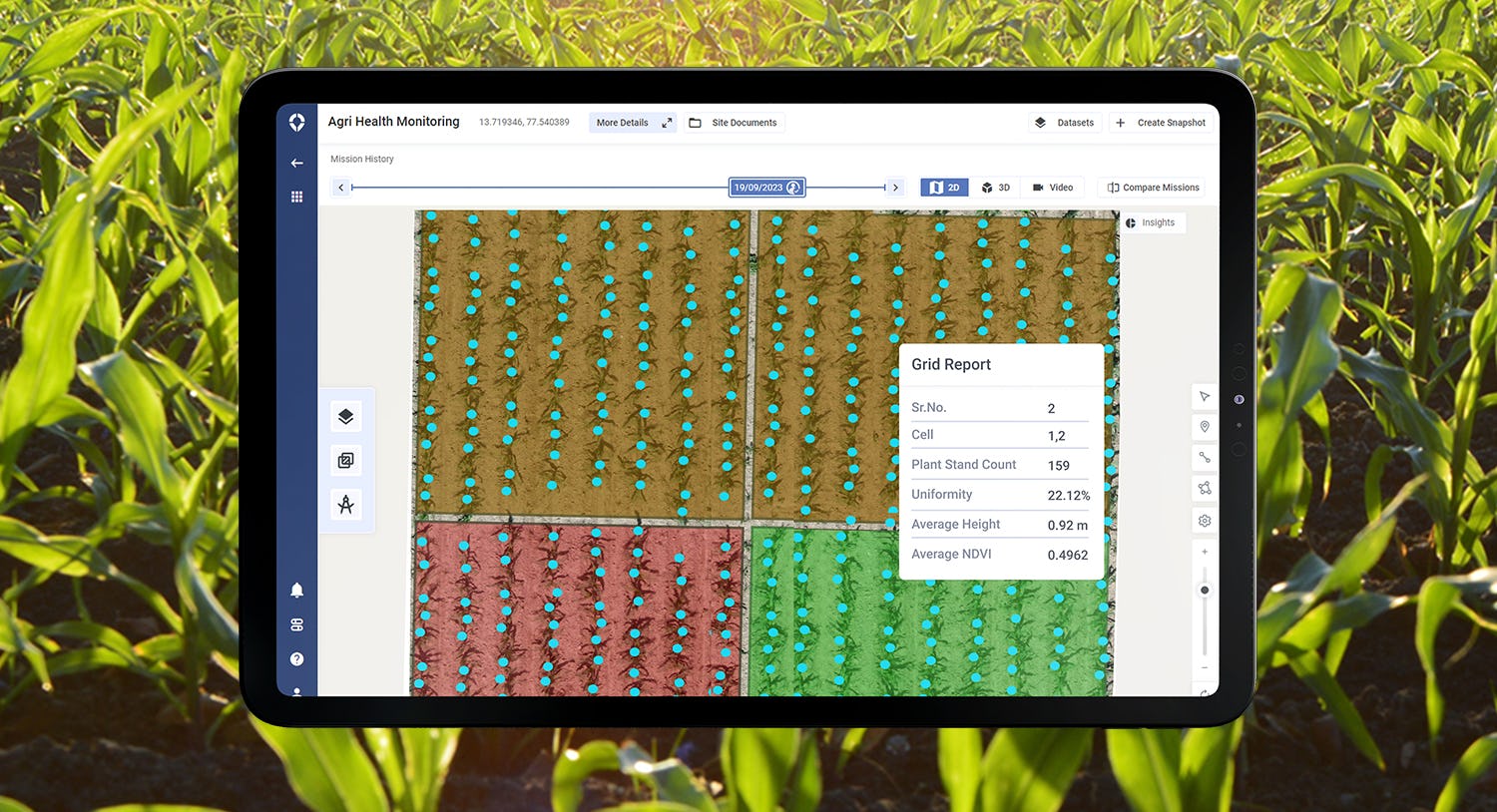
SkyDeck Software - Advanced corn phenotyping: Plant stand count, Uniformity, Height calculation, NDVI/NDRE
SkyDeck by Asteria Aerospace - End-to-End Drone Data Management platform for Accurate Insights 
Powered by Cloud & AI
SkyDeck Software - Enterprise Ready Cloud SaaS Platform - SkyDeck by Asteria Aerospace
(Key benefits of SkyDeck by Asteria Aerospace)
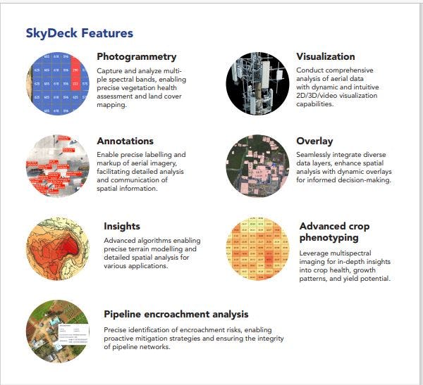
SkyDeck Software - Key Features of SkyDeck by Asteria Aerospace
End-to-End Drone Data Management platform for Accurate Insights
Recommended Drone Insights tool by Drone-as-a-service providers, DaaS Project Managers, Asset Managers, GIS Engineers/ Analysts
SkyDeck Software - SkyDeck by Asteria Aerospace.
Recommended Drone Insights tool by Drone-as-a-service providers, DaaS Project Managers, Asset Managers, GIS Engineers/ Analysts
Recommended Drone Insights tool by Drone-as-a-service providers, DaaS Project Manager - thumbnail
SkyDeck Software - Recommended Drone Insights tool by Drone-as-a-service providers, DaaS Project Managers, Asset Managers, GIS Engineers/ Analysts
SkyDeck by Asteria Aerospace - End-to-End Drone Data Management platform for Accurate Insights - thumbnail
SkyDeck Software - Pipeline Encroachment Analysis: Al-powered ROW encroachment detection, Encroachment type and severity classification, Distance of encroachment from pipeline, Closest chainage marker, Change detection between surveys, Multiple pipelines in ROW. 
SkyDeck - thumbnail
SkyDeck Software - Advanced corn phenotyping: Plant stand count, Uniformity, Height calculation, NDVI/NDRE
SkyDeck by Asteria Aerospace - End-to-End Drone Data Management platform for Accurate Insights 
Powered by Cloud & AI - thumbnail
SkyDeck Software - Enterprise Ready Cloud SaaS Platform - SkyDeck by Asteria Aerospace
(Key benefits of SkyDeck by Asteria Aerospace) - thumbnail
SkyDeck Software - Key Features of SkyDeck by Asteria Aerospace
End-to-End Drone Data Management platform for Accurate Insights
Recommended Drone Insights tool by Drone-as-a-service providers, DaaS Project Managers, Asset Managers, GIS Engineers/ Analysts - thumbnail

SkyDeck pricing

Starting Price:
Not provided by vendor
Free Version:
No
Free trial:
No

Alternatives to SkyDeck

OverIT Next-Gen FSM Platform

OverIT provides leading software solutions for end-to-end FSM at scale. Our ability to innovate is driven by our 20...

Foursquare Studio

0
Foursquare Studio is an advanced geospatial visualization and analytics platform. With Studio, you can join, enrich...

No reviews available

Software buyers need your help! Product reviews help the rest of us make great decisions.

Write a Review!

Related categories